
Search McNair Streets One Address at a Time
A street-by-street search in McNair works best as an address chain, not as a claim about every person connected with a road. The county assessor can connect a number and street to a PIN or tax-map reference. Jade then places that parcel among address points, subdivisions, common areas, roads, and nearby public layers. A recorded instrument can identify a conveyance, while a directory or election source is time-bound evidence rather than a current roster. Keep the source date and the exact address form with each result.
- Normalize the address through the USPS lookup, retaining the source spelling, unit, Herndon postal city, and ZIP.
- Search the address in Fairfax iCare and record the owner or entity, PIN or map number, legal description, sales fields, assessment fields, and physical characteristics that display.
- Open the same address or PIN in Jade. Check the parcel, address point, subdivision, common area, road, and current boundary layers before exporting only the selected features needed.
- Use the owner or legal description in the Fairfax Circuit Court Grantee and Grantor indexes. Capture the deed date, book and page, instrument number, and the prior-conveyance reference when an image is available.
- For a dated household lead, consult a relevant Herndon, Reston, telephone, or criss-cross volume at the Virginia Room. A directory entry must remain tied to its edition year.
Note: McNair is a Census Designated Place, so a Herndon, VA 20171 postal label does not turn the address into Town of Herndon jurisdiction.
McNair Street Directory Searches in iCare
Fairfax County Department of Tax Administration iCare is the starting point for the parcel side of a McNair street directory. The public display is authorized under Virginia Code §58.1-3122.2. It offers current ownership, sale, assessment, and parcel-characteristic context, with ownership and characteristics updated twice each week and assessed values set as of January 1. The county warns that displayed parcel edges are not a legal survey, and an owner name may be withheld from the internet record. An absent internet name therefore does not establish that an ownership record is missing.
The address form is flexible enough for a broad first pass and a more exact follow-up. Omit a suffix when a narrow search misses a result. The portal itself suggests a wildcard such as *woodland for a street-name fragment or *woodland drive to retrieve all street types. Copy the map number exactly once it appears, because spaces and suffix characters can matter in later searches.
| iCare field or control | Input and use |
|---|---|
| Number | Optional text for the street number |
| Unit# | Optional text that keeps units on one parcel distinct |
| Street | Optional text, with * supported for broad fragments |
| Suffix | Optional dropdown; omit it for a broader street-name result |
| Sort and results controls | Choose result order and results per page before Search |
| Map Number | Required on the separate map-number search; accepts all or part with wildcard syntax |
Fairfax iCare’s address search shows the number, unit, street, suffix, sort, and result controls used for McNair address research.
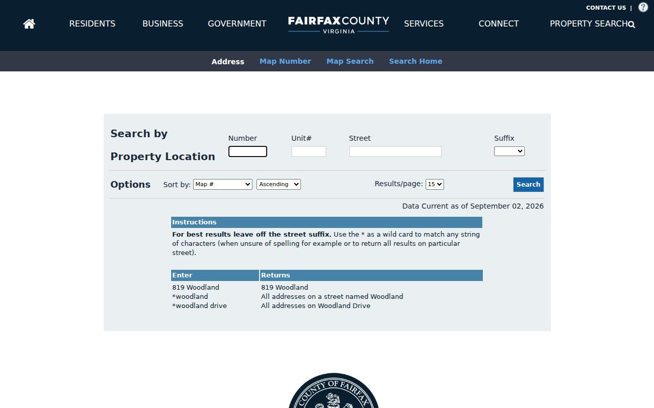
Use the initial street result to select one record, rather than assuming that similar street names refer to the same parcel.
The iCare map-number search is the second route after a McNair address yields a PIN or tax-map reference.
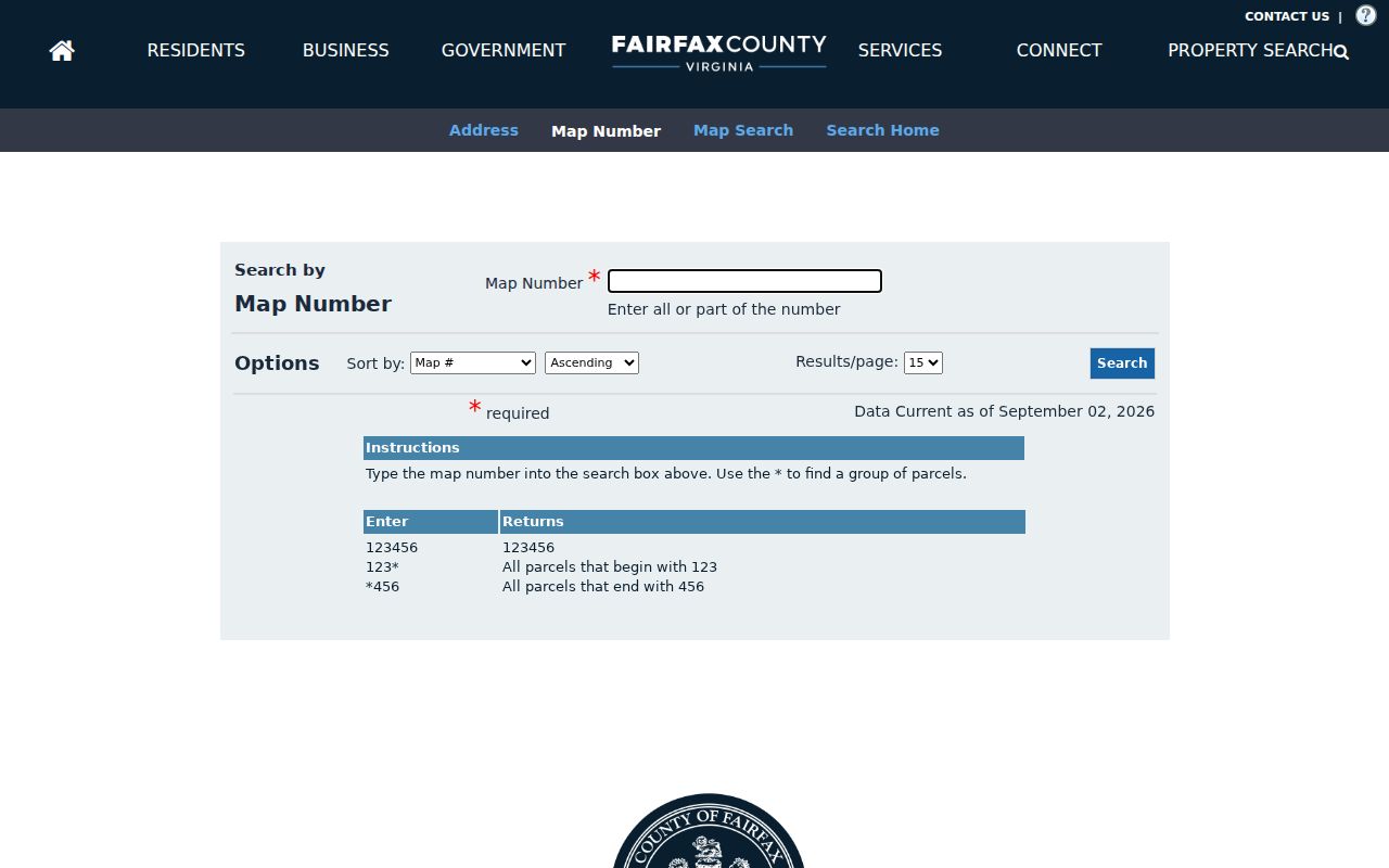
A PIN is a stronger bridge between county systems than a street name alone, especially where a road name or suffix has changed form.
McNair Streets Through Jade Parcel Layers
Jade supplies the spatial side of a McNair address. Its global search accepts an address, street, or location. The Searches tab adds Parcel Search with PIN autocomplete, Address Search with House Number, Street Name, and Type, Street Intersection Search, and Subdivision Search. After a result is selected, the map supports click or rectangle selection, feature zoom, buffers, combine and remove actions, property reports, historical imagery, and selected-feature exports in CSV, XLSX, or zipped shapefile form.
The useful layers for a block are address points, parcels, subdivisions, common areas, rights-of-way, tax-map grid, and Parcels by Owner. The last category distinguishes government, HOA, place-of-worship, and public-service parcel classes. It does not publish a roster of people. Jade’s property, planning, community, infrastructure, environment, basemap, and imagery groups make it possible to separate a parcel fact from the service geography around it.
Jade’s official search help documents its address, parcel, intersection, selection, buffer, and export tools.
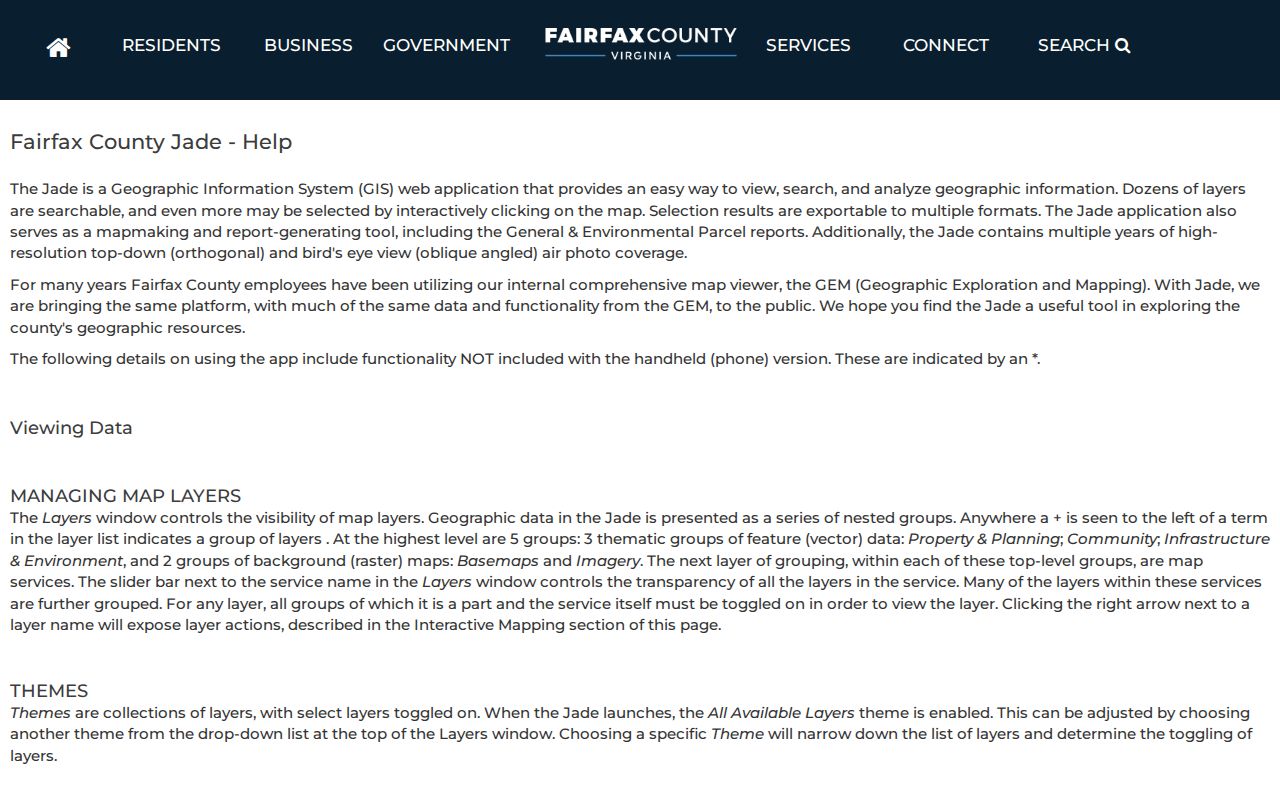
For historical context, Jade lists aerial imagery from 1937 through 2017. An aerial can show road or building change, but cannot identify who lived at a structure.
McNair Address Records Compared
Each McNair address record answers a narrow question. The table keeps the county systems apart, including the distinction between a parcel owner, a recorded party, and a person connected to a dated directory listing. Record the displayed address, date range, source URL, search string, PIN or instrument number, and whether the result was directly displayed, indexed, or transcribed.
| Address-keyed source | Custodian | What it can establish | Access path |
|---|---|---|---|
| iCare parcel and assessment record | Fairfax County Department of Tax Administration | Owner or entity when displayed, PIN, property location, sale and assessment context | Public web display; owner name can be withheld |
| Jade parcel and address layers | Fairfax County GIS | Parcel location, address point, subdivision, common area, road, and mapped context | Public web map and selected-feature export |
| Recorded land instruments | Fairfax Circuit Court Land Records and CPAN | Grantor, grantee, date, book and page, instrument number, legal description | CPAN subscription or courthouse and Historic Records Center routes |
| PLUS, LDIH, and SRV | Fairfax Land Development Services | Public development-record metadata, address, parcel, project, and retention context | PLUS for current records; LDIH for older uploads; SRV for approved site records |
| Directory and telephone volumes | Fairfax County Public Library Virginia Room | Dated subscriber or household clues in a specific edition | Library collection, CPAN station, and microform research |
Do not convert a mailing address into a situs address, a recorded owner into an occupant, or an entity’s name into an individual-resident claim. Those are separate roles in the McNair record trail.
McNair Street Work in PLUS and LDIH
Fairfax Land Development Services uses PLUS for new land-development records, following its October 31, 2022 launch. PLUS searches include Site Address, Contractor License Information, Parcel Number, and Record Information. The public form exposes record number, record type, project name, dates, address components, parcel ID, additional criteria, and Search or Clear. Older uploads belong in LDIH, which updates nightly, while SRV carries thousands of approved site records with geographic search support.
Clear the form before an address query. Fairfax’s tip is to enter *Street Number and *Street Name, omit the street type, and choose the right result if several appear. Current record numbers use a form such as XXXX-2022-00001; legacy systems can use other syntax, and FIDO records can require a leading *. An applicant, owner, or contractor in a result is connected to the record’s role, not necessarily to present occupancy.
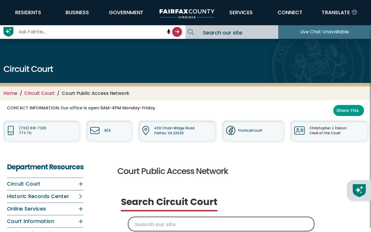
Fairfax CPAN’s official description identifies the subscriber route for the land and court record collections used beside PLUS and LDIH.
Building plans and supporting documents may be destroyed three years after final inspection, while certain bonds, agreements, and site-plan materials are retained five years after completion. A missing plan is not proof that work never occurred.
McNair Street Directory Deed Chains
The Fairfax Circuit Court is the custodian for land instruments from 1742 to the present. CPAN provides a subscriber route for land records, with land-record images from 1742 forward, index data from 1980 forward, and index-book images for 1742 through 1979. The courthouse and Historic Records Center are the fallback when an image or older index is not available online. CPAN’s first quarterly payment is $150 per user, while a certified copy through Circuit Court costs $2 per document plus $0.50 per page.
Start with the Fairfax County Tax Map Reference from iCare. In Fairfax terminology, a grantee is the buyer and a grantor is the seller. From the current grantee entry, note the parties, deed date, book and page, instrument number, and legal description. The phrase identifying the same parcel of land often points to the earlier deed, will, or other source. If it does not, search the grantor and grantee indexes again with an approximate date, locality, and parcel clues.
- Parcel
- A mapped unit of land in the county system, commonly joined to other county sources with a PIN or tax-map reference.
- Situs address
- The property’s physical address, which can differ from a mailing address in a tax or deed record.
- Plat
- A recorded map or plan connected to land; a house-location plat may not exist for every property.
- Criss-cross directory
- An address-arranged directory that can offer a dated lead for a particular street, subject to the edition’s coverage.
An official iCare sample parcel result illustrates the distinct owner or entity, property-location, and PIN fields used in a McNair-area address trail.
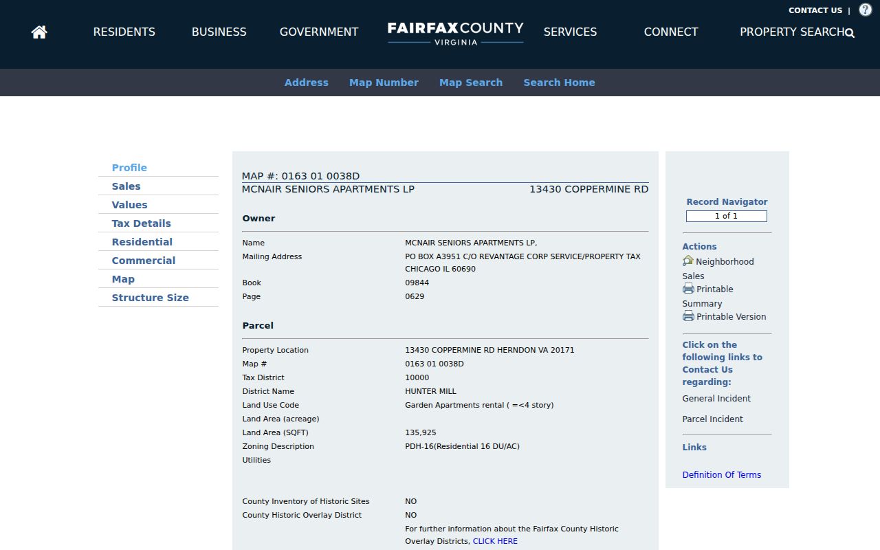
The sample names an entity at a McNair-area property. It is a parcel-record example, not evidence that any particular individual lives there.
McNair Street Directory Postal Checks
McNair CDP and the postal city are different fields. Official county sources use Herndon, VA 20171 for McNair addresses, while the nearby Town of Herndon uses a 20170 postal location. USPS says a ZIP result does not confirm that a person or company is at an address. Keep the source text, standardized number and street, unit, postal city, ZIP+4, county, CDP, PIN, precinct, and subdivision in separate columns instead of forcing one label to do every job.
Jade, iCare, My Neighborhood, and USPS can legitimately return different geographic labels because they answer different questions. Jade supplies parcel and boundary context, iCare supplies the tax-account context, My Neighborhood supplies address-based services and precinct information, and USPS supplies delivery formatting.
McNair Street Records Have Different Dates
A McNair address can look current in more than one system while each system is reporting a different date. iCare sets assessed values as of January 1, while property ownership and characteristics are updated twice each week. A deed’s date records an instrument event, not a later portal-refresh date. A PLUS result has its own project, review, inspection, and retention timeline. Jade imagery needs its exact aerial year, and a My Neighborhood result needs the date it was searched because service areas, officials, and polling places can change.
Record the displayed date beside the source name. That small practice prevents a street-by-street comparison from silently treating an assessment date, a deed date, an aerial year, and a portal lookup as the same kind of current fact. When a source changes, retain the earlier source date and state what the record actually displayed.
McNair Street Directory History Sources
For a past household lead, use the Virginia Room’s exact editions instead of guessing from a regional title. Its holdings include Herndon Area Directory volumes for 1962 and 1967, Herndon-Reston Community Directory volumes from 1979 through 1985, Northern Virginia and Washington white pages, and Reston/Herndon/Franklin Farm phone books. Fairfax criss-cross titles have territorial limits, so each volume needs an edition-level coverage check before a McNair street is treated as included.
The Virginia Room at City of Fairfax Regional Library combines directories, maps, newspapers, yearbooks, a CPAN station, and a microform reader-printer. That makes one visit useful when an iCare PIN, a deed book and page, a directory year, and a newspaper or yearbook lead need to be compared. For an address-centered historical trail, the collection details are handled on the McNair city directories page.
Limits of a McNair Street Directory
A McNair street directory cannot establish a complete list of current occupants. iCare reports parcel and assessment information and may withhold an owner name from online display. A deed party can be a buyer, seller, trustee, or other recorded role. A directory entry is dated, and a postal delivery result does not prove a person or company is present. Court files may be confidential, vital records have separate access rules, and an address protected under Virginia’s Safe at Home program must not be reconstructed from historical or parcel material.
Virginia Code §2.2-515.2 protects the actual address and phone information of qualifying Safe at Home participants. Protective-order confidentiality can also shield residential address, phone, and related location information. Preserve a negative result as “not located in this source” instead of converting it into a claim that no record exists.
Lawful use. Use McNair address records for personal, lawful research and treat protected or uncertain information with care. Never use a record trail to stalk, harass, or harm anyone.